

Why Are Drones The New Name in Optimized Surveillance For Law Enforcement?
Drones are considered optimal for surveillance in law enforcement as they have sensors like heat sensors and technology like thermal cameras. These components ensure that they can track criminals, detect the presence of suspicious substances, and prevent crimes.
Ever since the advent of drones, they have become significant in surveillance due to their multifaceted capabilities.
Real-time monitoring while in the air and systems in place for immediate response to any emergency scenario are two critical factors that have quickly made drones irreplaceable devices for surveillance.
For instance, British police in Lancashire used drones more than 390 times in January and February 2025. So if you’ve been considering drones for your own police force but aren’t sure, continue reading below to learn more.
What Impact Can Drones Have on Surveillance Systems In Law Enforcement?
Drones are characterized by their small size, aerial maneuvering capabilities, and the ability to survive in harsh conditions.
They are referred to as unmanned aerial vehicles (UAVs), which also implies better vantage points, making surveillance more effective than systems that are limited to ground levels.
For instance, drone surveillance systems are quickly gathering traction among law enforcement and security companies as a suitable measure of crime prevention and contingency.
A reason for this can be the highly technical nature of drone cameras, such as UAV thermal cameras. These cameras can pinpoint suspicious objects or persons of interest through heat signatures.
Thus, drones can track suspicious activities even in low-light or extremely dark conditions.
Why Drones Are the Future of Surveillance, Security, and Crime Detection?
Drones are unmanned units. This implies that the human element is eliminated in the field of danger. So, not only can police personnel be protected from potentially life-threatening situations, but the margin of police error can be drastically reduced.
Thus, as a safer and more efficient surveillance system, drones can become the go-to security and crime detection systems of the future. In fact, more than 290,000 drones are set to be used by public safety agencies as of 2025.
How Does Drone Surveillance Work?
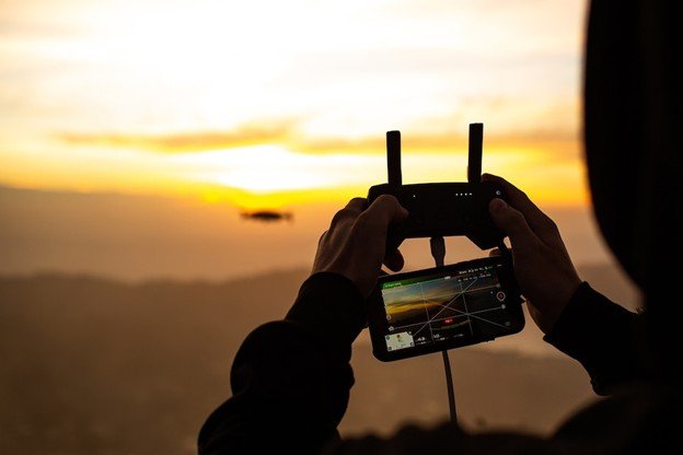
Drones are mobile aerial surveillance units with different types of sensors and other technology. Their operators use computer-centric interfaces to control and fly the drones towards their intended destination.
Sometimes, however, they use pre-planned flight paths to make the drone fly towards the target, maintain a specific altitude, and return to the base.
Throughout the operation, drone operators communicate with the drones through radio waves and cellphone-based networks.
During the operation, these operators utilise cameras like UAV Thermal Cameras to capture heat signatures and sensors like heat sensors to detect anomalous temperature spikes and respond quickly to incidents before they can unfold.
Once the drones return to the base, the data they gathered is studied, based on which the required decisions are taken.
How Does Planning the Flight Path Help Drone Surveillance?
While drones are unmanned aerial vehicles, drones are controlled in two types, namely:
- The drone is controlled by police personnel through a remote control from a distance
- It flies in accordance with a preset flight path.
Here, the discussion will focus on how the latter can be critical to optimizing drone surveillance.
What Role Does Data-driven Flight Planning Software Play in Optimizing Drone Activities?
You can only define a drone flight path if you:
- Know the objective.
- Have defined boundaries for the area for the drone to cover
- Are aware of the required flight altitude for ideal camera angles.
Therefore, for the most appropriate automated drone surveillance application, data-driven drone flight planning will be necessary.
One of the most important things that data-driven planning software does is create two-dimensional or three-dimensional maps from the captured images. These images can be utilized to create a map for the drone to follow.
The map thus created can determine the appropriate height for the drone’s flight, the boundary limits for the flight path, and define the drone’s ideal path. UgCS is one example of a data-driven flight planning software that can be used to create automated drone flight plans.
Why is UGCS relevant for Drone Surveillance?
UgCS is a computer software that helps in the development and execution of flight plans for automated drones. The specific capability that makes UgCS a more effective drone flight-planning software is its ability to support planning for areas in complex terrains.
What Potential Do Drones Have As The Future of Law Enforcement?
Drones have an enhanced potential to optimize surveillance and the prevention of crime in law enforcement, as seen below:
Real-time Monitoring and Surveillance
UAV Thermal Cameras can help drones pinpoint anomalies even in low-light conditions, while systems such as UgCS can define the most effective flight plan for an unmanned drone.
Hence, drones have an effective real-time monitoring capacity regardless of the harshness of the conditions in which they operate.
Law enforcement can therefore potentially use drones for surveillance purposes as well as for real-time monitoring of potential crime scenes, high-risk areas, or criminal hideouts. This can be seen in the fact that more than 70% of drones are utilized to monitor crime.
Tracking and Identification
Drones are effective trackers as they can chase down criminals, tirelessly and relentlessly. Drones can also ‘remember’ objects or faces from images they have previously captured.
Moreover, drones can be effective as mitigators of criminal activities through their capabilities to track them through uneven terrain.
Wrapping Up
Drones can be utilized as efficient surveillance tools and effectively aid law enforcement officials in preventing crime.
Their thermal cameras can track criminals’ heat signatures. On the other hand, their heat sensors can pinpoint the presence of suspicious objects like charged explosives. You can also use software like UGCS to have them fly on preset flight paths on uneven terrain.
This will ensure that criminals can be tracked down, irrespective of their location.
Enhance Your Law Enforcement Operations
You should therefore choose drones from reputable suppliers and ensure that these drones are equipped with the latest sensors and technology. That way, you will be able to catch criminals effectively and prevent unwanted crimes.